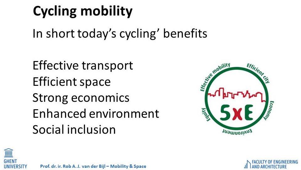
Advanced planning for cycling
A mobility oriented research into safety and inclusion
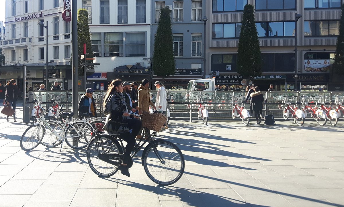
In order to reduce transport poverty in Antwerp (Belgium) the question is how to enhance safety and accessibility, and how to boost the use of cycling.
Advanced planning for cycling in Antwerp (short version)
By Tobias Hooftman (Master student at Ghent University, Belgium, January 2019)
Full version … (Sorry, in Dutch only)
Safety and inclusion
Answering this question involves two main issues: safety and inclusion. In terms of safety, late 2017 staged a sad all time low record in Antwerp, when 2 bicycle deaths occurred in just 2 weeks at a so-called “black intersection.” Cyclists felt unsafe and abandoned. Regarding inclusion, transport poverty represents a major obstacle. Many citizens are less mobile than they would like to. Their transport poverty (or mobility disadvantage) has an impact on the opportunities getting jobs, accessing suitable schools, using health care, and so on.
The focus of traditional transport planning is on traffic and traffic flows, infrastructure and planning by experts. Contrary in Sustainable Urban Mobility Planning (SUMP) the focus is on people and liveability, whereby the planning also involves different stakeholders. In order to use SUMP and its principles, our research backs the implementation of 6 steps which can be taken within a ‘Fava-style’ incremental planning process (see also Backgrounds).
6 steps
- Analysis of the city
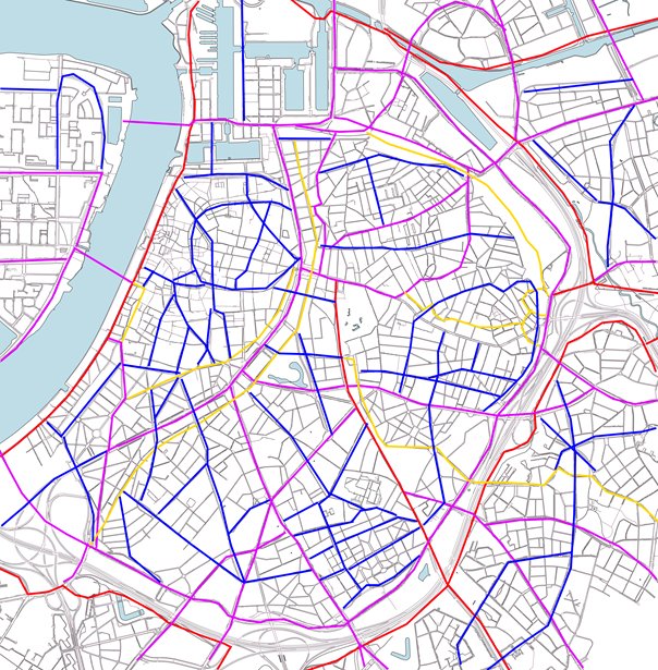
Distinction between (1) main cycle network and (2) city cycle network. The first network entails routes within Antwerp’s agglomeration (red) and connecting routes in the city (purple), including a number of local connections (yellow). The second network consists of routes in precincts (blue) and in neighbourhoods (grey).
- Long term vision
General sketch of main routes and car-free zones as a reference for the following steps.
- Short term actions
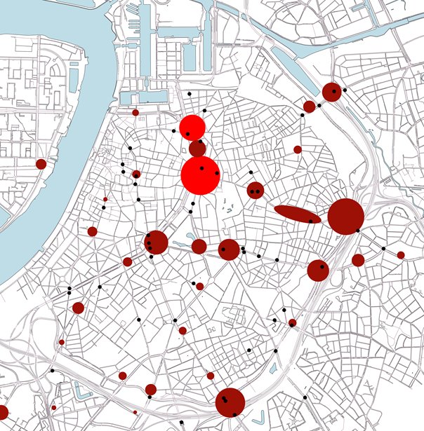
“Hot spot approach” (see map), based on police data about unsafe places. This mainly concerns those places and spots where bicycle traffic encounters car traffic.
- Creation of car-free zones
Substantial expansion of care-free territory to achieve traffic safety, personal health, improved environment, reduced noise, efficient use of space and enhanced aesthetics. Our proposal is to transform a substantial portion of Antwerp Centre’s public realm into a car-free zone. This requires political courage, but would enormously increase liveability and bicycle use in the central city.
- Inventory of major projects
Proposal to re-profile a boulevard and thereby improving its design for cycling (and walking), as well as a new cross-river connection for cyclists (and pedestrians).
- Branding of cycling
Proposal to standardize logos for bicycle use and public transport in Antwerp.
Conclusion
Advanced planning for bicycles requires a constant balancing act between individual safety and safety in societal perspective. Increasing cycling safety and popularity can reduce transport poverty among vulnerable groups.
Backgrounds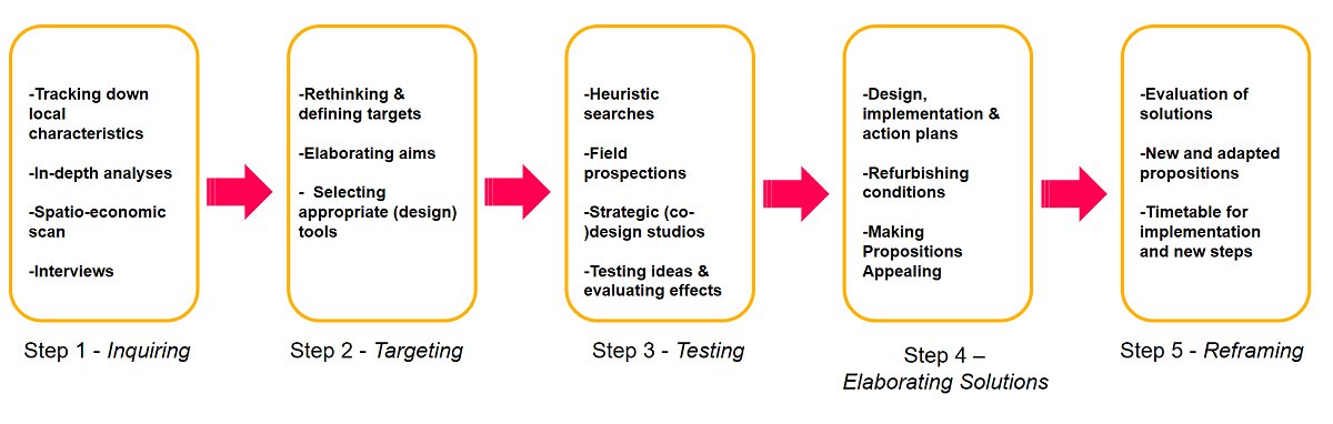
The SUMP inspired ‘6 steps’ research presented here fits within the ‘5 steps’ of the ‘Fava-style’ incremental planning process. Particularly Fava’s steps 1, 2 and 4 are mirrored in the project of Master student Tobias Hooftman. In Antwerp too, solutions for safe and inclusive cycling are ‘around the corners’ of streets, locally, bridging between people, profit and planet.
Favas.net: January-May 2019
Antwerp (Belgium)
Credits
Special thanks to Ghent University.
All data and material used in this research are obtained from secondary sources/resources.
Main text and all maps by Tobias Hooftman.
Added image at this page by Favas.net.
Hooftman’s research and paper (see full report, in Dutch) are based on the Course ‘Mobility Planning’, supervised by professor Rob van der Bijl, Ghent University, 2018-2019.