
City Maps – Mumbai
Maps mark the urban and social shape of cities (introduction)
Unlocking by mapping
The series ‘Maps mark the urban and social shape of cities’ unlocks knowledge about the selected city. To introduce the series on Favas.net, the metropolis of Mumbai in India was chosen. The regular episodes show cities using original maps (and supporting photos). The tension in the series arises from the combination of map and city. Sometimes an unknown map provides a familiar image of the city, at other times a very well-known or trivial map offers an unexpected perspective on the city, but above all, the aim is always to expose spatial and social situations within the city.
Mumbai, city of slums
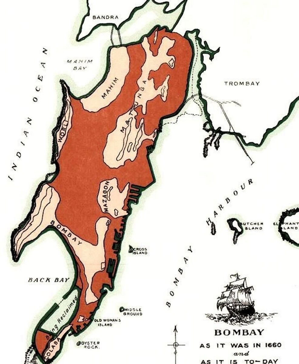
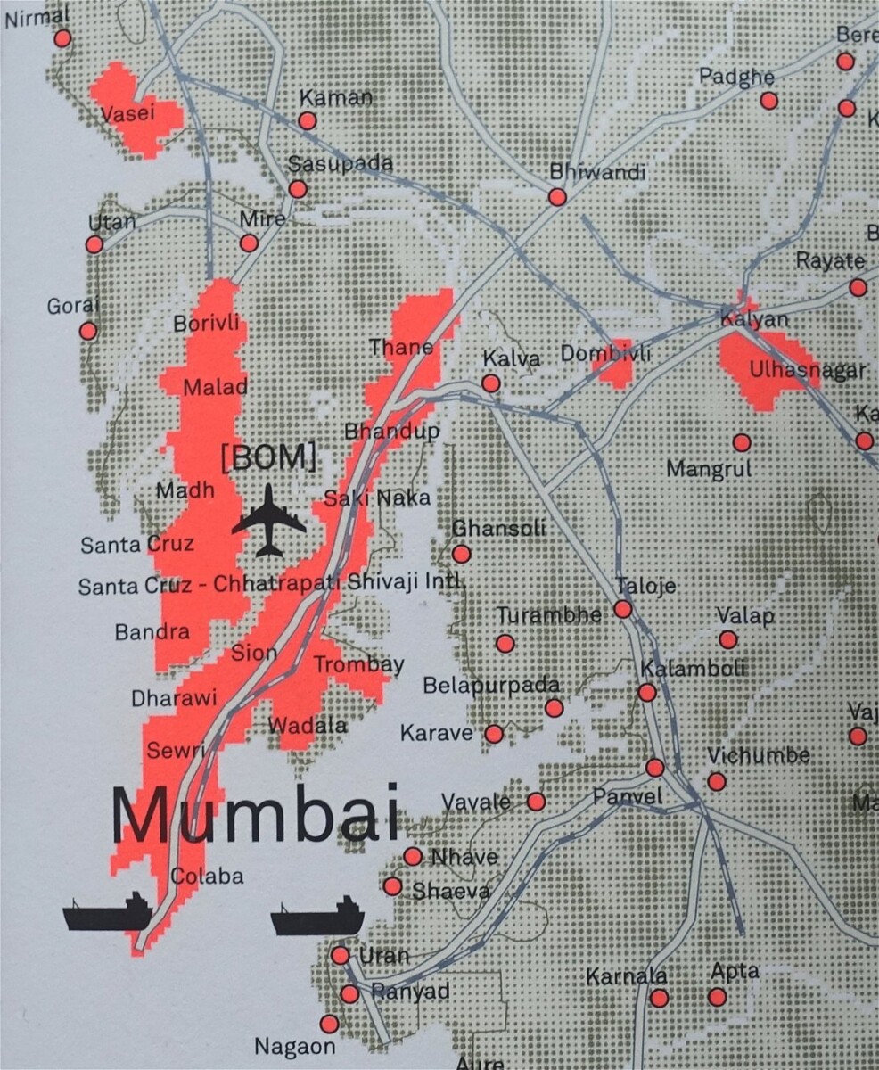
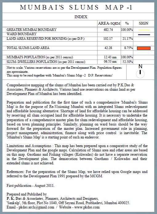
First and foremost, Mumbai is a metropolis with an enormous number of slums. This is significant for the social situation of India and Indian cities. In the map image below, the Mumbai’s slums map by P.K. Das et al. (August, 2011) is combined with a historical map (John Bartholomew & Co., 1998).
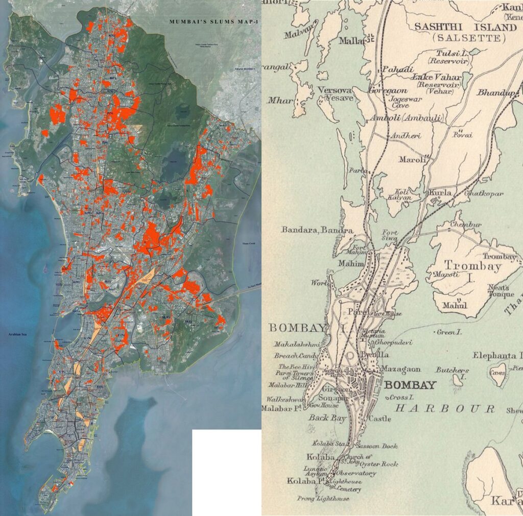
When creating his map, architect Das estimated that 60% of Mumbai’s inhabitants lived in slums, corresponding to 7.5 million people at the time (2011). A staggering number.
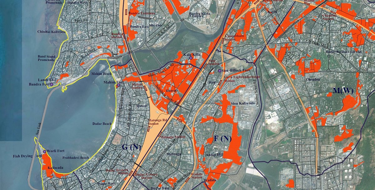
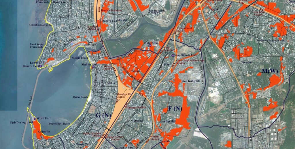
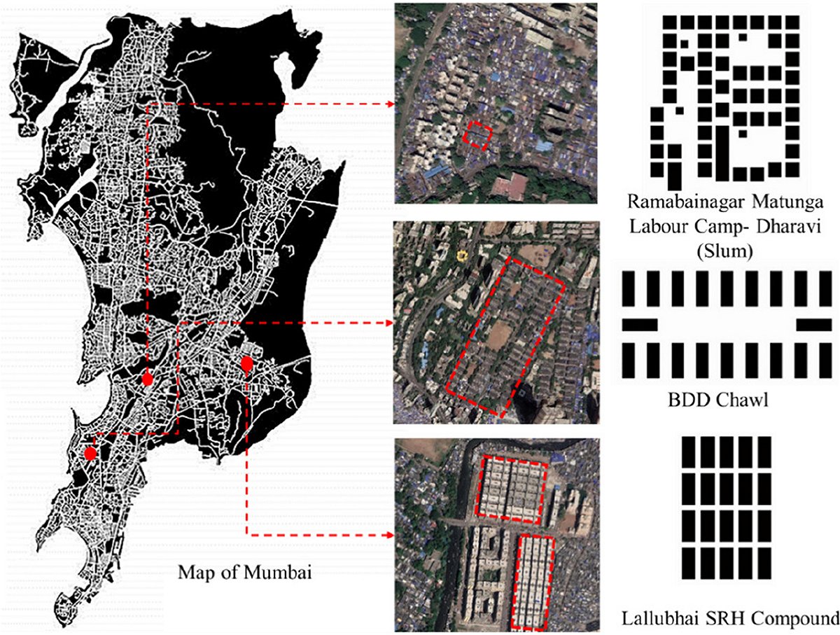
Dharavi
When zooming in on the slums map, the contours of Dharavi become visible, one of the largest slums in the world, with over a million inhabitants. Below are two fragments from the map, respectively Dharavi’s vicinities and area. The latter is captured in a third map image extracted from Open Street Maps.
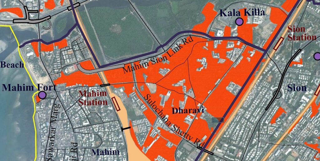
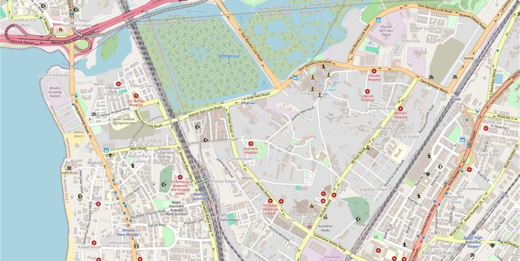
Dharavi is an ethnic melting pot unparalleled even in India. All this in a relatively small area of approximately one and a half square kilometres with an unprecedented amount of economic and social activity.
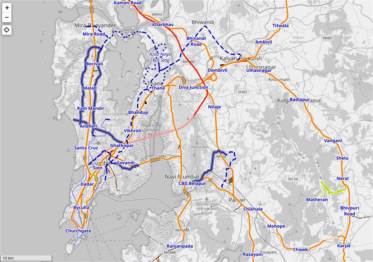
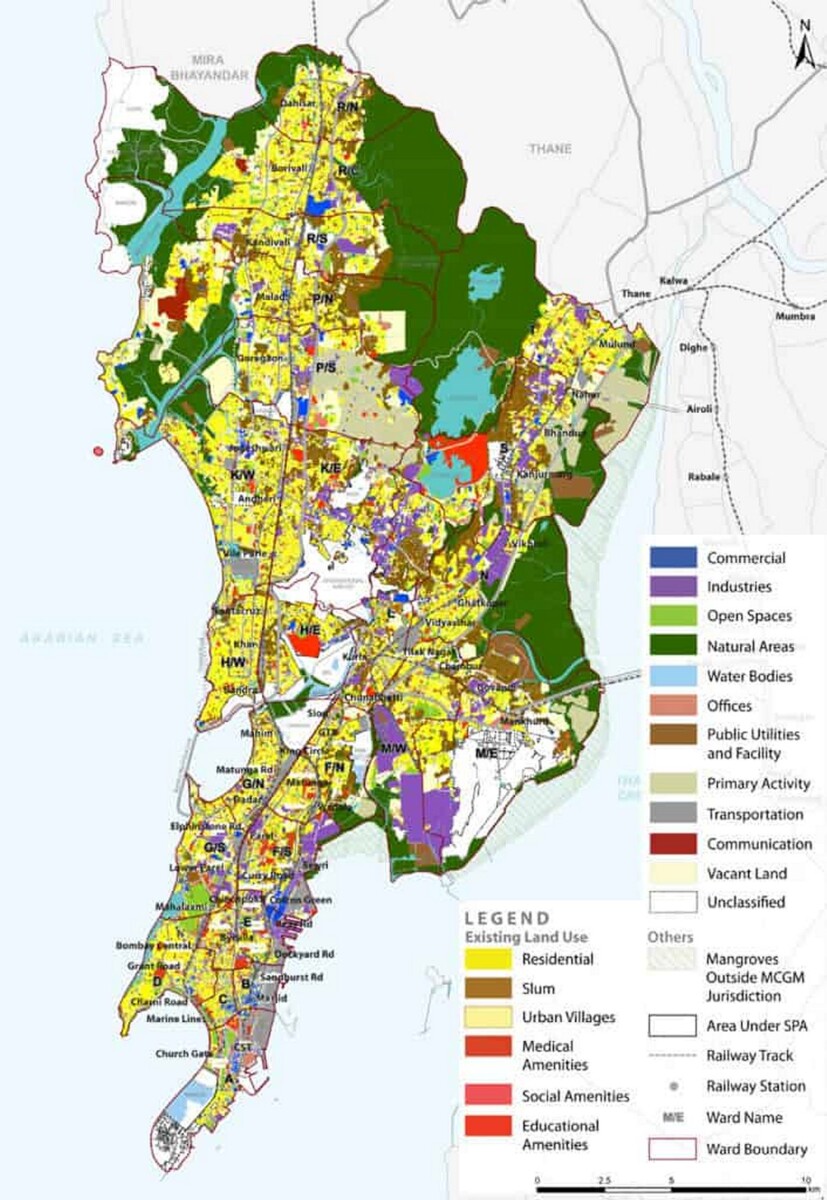
More maps
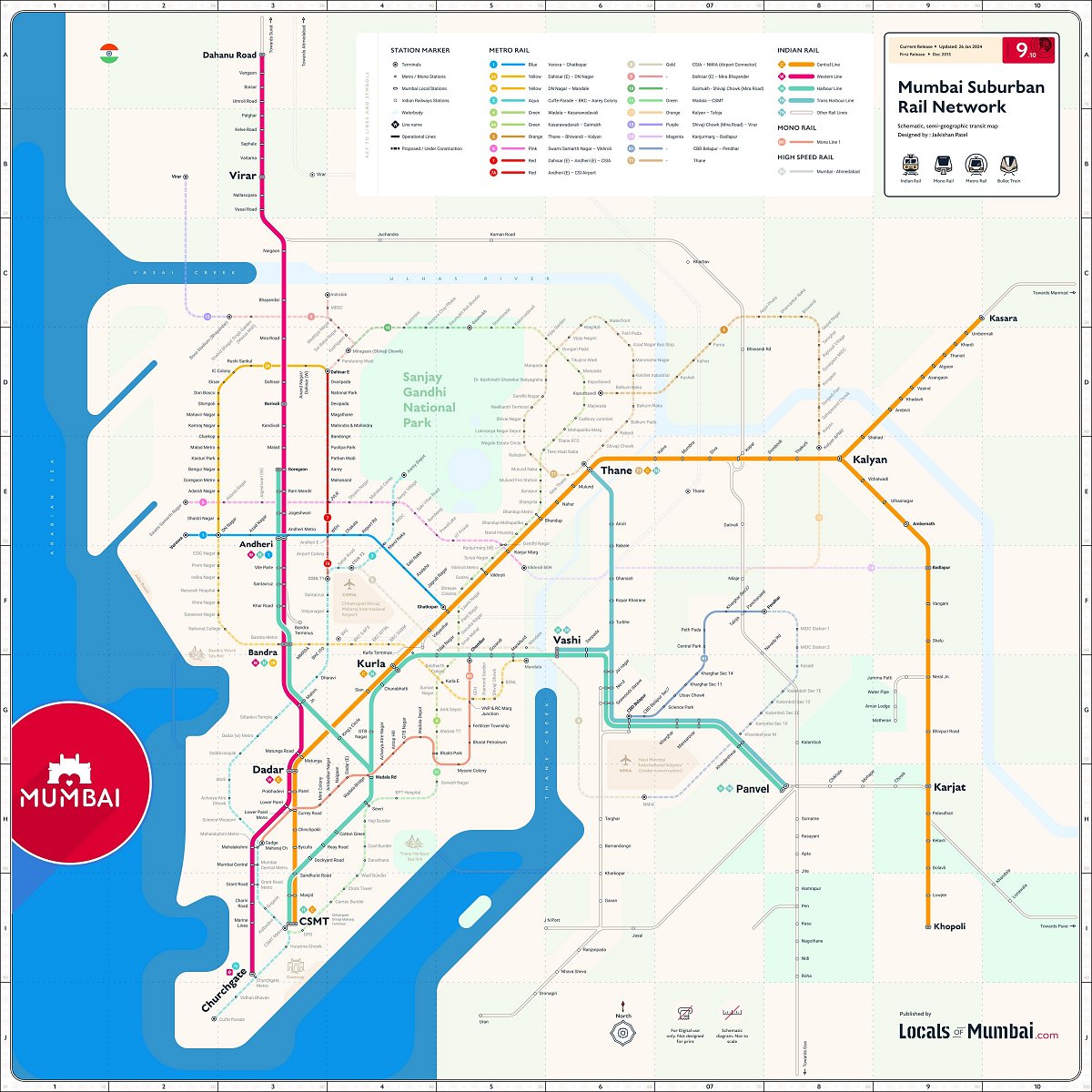
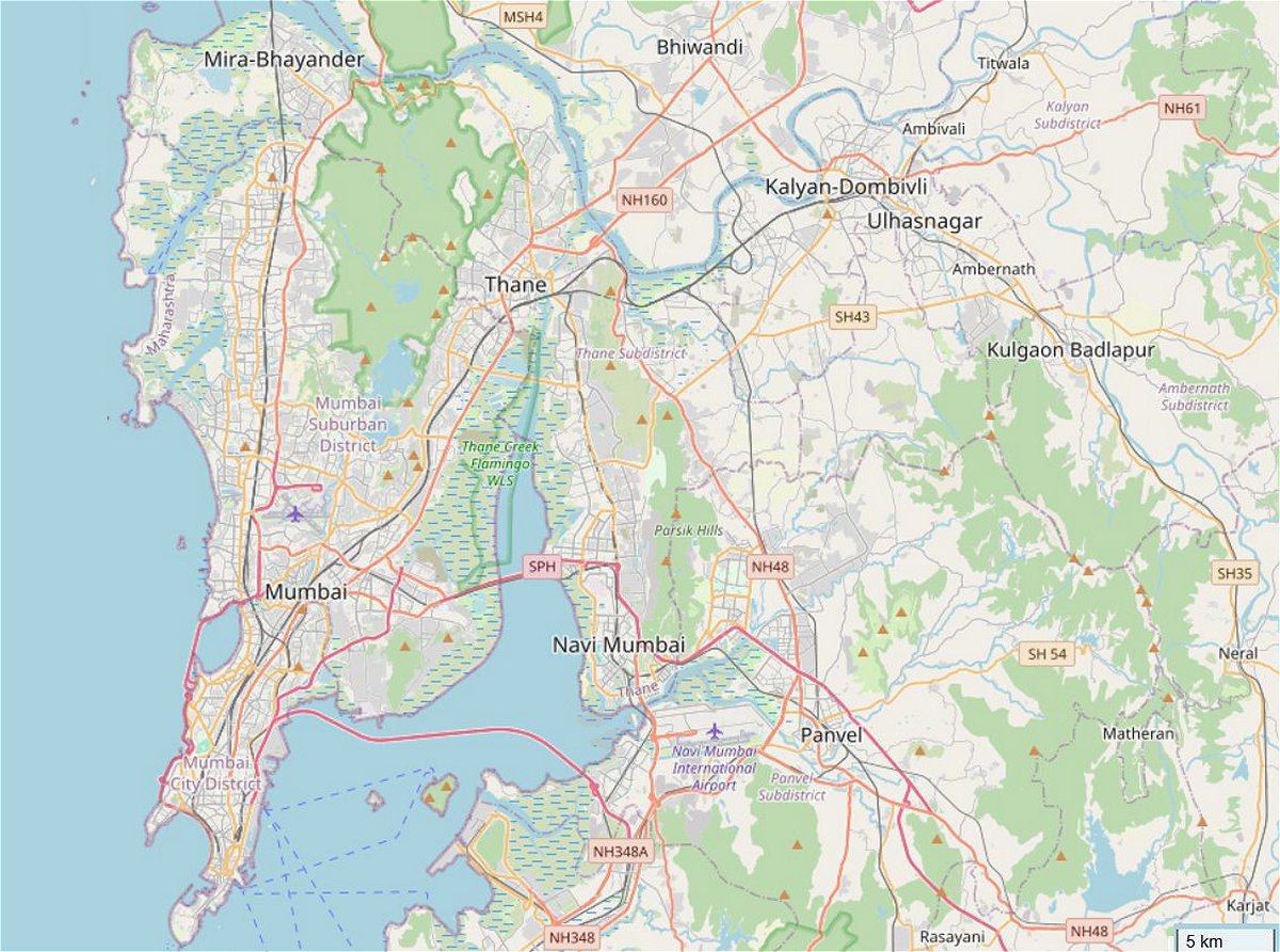
The huge and complex city of Mumbai deserves more map images. In the gallery below various themes are depicted. Like, history, car infrastructure, public rail transport, land-use and urban planning. To be continued …
Maps mark the urban and social shape of cities
To the regular episodes:
LA (California, US) & The Hague (Netherlands)
Fenglin (Taiwan)
Rio de Janeiro (Brazil)
Upcoming episodes:
Warsaw (Poland)
Belfast (Northern Ireland)
Parijs (France)
See also:
101 metropolises (at Favas.net)
Unequalscenes.com/mumbai
Acknowledgements
Text: Favas.net (Rob van der Bijl).
Map images: editing RVDB Urban Planning (courtesy OpenStreetMap and many others).
Index Mumbai’s slums map:
The series ‘Maps mark the urban and social shape of cities’ unlocks knowledge about the selected city. Mumbai (India) is used as an introduction.
The series ‘Maps mark the urban and social shape of cities’ is based on the former series Plattegrond, in Blauwe Kamer, a Dutch magazine for landscape architecture and urban planning (the series was published 2003-2020).